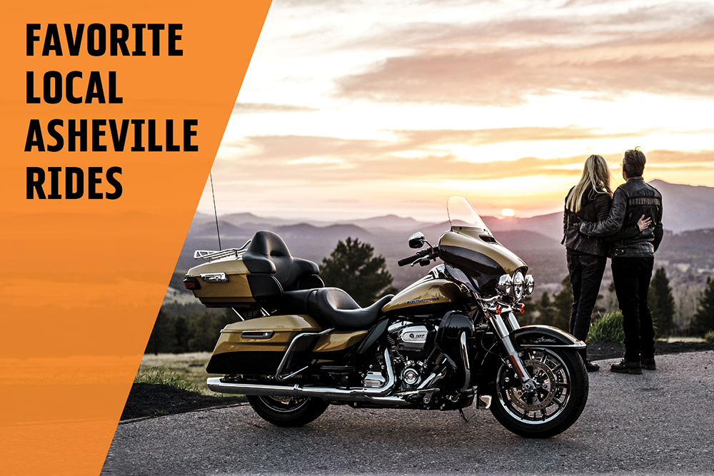
Our Favorite Local Asheville Rides
Summer is almost here, and it’s time to plan some local rides! There is no shortage of gorgeous scenery in WNC. Here are some of our favorite rides, recommended by our team, our HOG members, and our friends! Save this list for your next ride, and share it with your riding friends!
Our Favorite Local Rides
- Tail of the Dragon
- Marion to Erwin TN to Asheville
- Blue Ridge Parkway
- Copperhead Loop
- Diamondback
- The Rattler
- Waterfall Byway
- Cherohala Skyway
- Devil's Whip
Tail of the Dragon
The Tail of The Dragon at Deals Gap, North Carolina is one of America's #1 motorcycle and sports car roads. With 318 curves in 11 miles, it is also one of most exciting routes to ride. Riders and drivers from across the US, Canada, and many other foreign countries come to The Tail of the Dragon to test their riding skills from April through October. The Tail of The Dragon is truly a unique road. There are only two intersections within the 14 miles of road. The area is remote, with most of the roadway bounded by Great Smoky Mountains National Park, and other forested land. Located about a 2 hour ride west of Asheville, this stretch of road will take you through some of the great towns and communities of western North Carolina including Waynesville, Cherokee, and Robbinsville.
Marion to Erwin TN to Asheville
Recommended by Allen Miller!
Start at Highway 80 in Marion which is part of the Diamondback. Follow it all the way to the end of Highway 80, crossing 19E. Going into the community of bandanna, you’ll come out on a road called Mine Creek Road. Take a left and stay on that road till it ends. You'll get onto 226A at Loafers Glory. Taking another left, stay on 226A until you get to NC197 at Red Hill Grocery. Take another left and you will be on Green Mountain Road, which follows the Toe River. In a couple of miles, Green Mountain Road will turn to the left.
You’ll stay to the right. You’ll be on Toe River Road which runs along the river and back into NC197. Take a left which will take you to the small community of Popular where there’s a huge car show there in July every year. You'll travel across Unaka Mountain into Erwin, Tennessee. Then take I-26 and travel the most beautiful part of of the road back to NC and into Asheville.
Blue Ridge Parkway
The Blue Ridge Parkway in North Carolina weaves through so many vibrant and engaging communities. The headquarters of the Blue Ridge Parkway is located in Asheville, North Carolina, a city well known to literary figures including Carl Sandburg, Thomas Wolfe and F. Scott Fitzgerald. Exploration of their homes and haunts in the Asheville area presents an interesting side trip and a one or two day break from driving.Cumberland Knob, MP 217.5
Located near the Virginia state line, Cumberland Knob is the site where construction of the Blue Ridge Parkway began in 1935. It was the first recreation area opened to the public and remains a favorite destination for both locals and visitors. The mixture of lush woodlands and open fields, housing a variety of birds and other wildlife, is ideal for leisurely walks or a more demanding hike to nearby Gully Creek.
What to Do
- Explore the Cumberland Knob visitor center to learn how to get the most out of your visit.
- Enjoy bird and wildlife watching.
- Take a leisurely hike through natural beauty or challenging hike to nearby Gully Creek.
- Rejuvenate and enjoy a packed snack or lunch at a picnic area.
Doughton Park, MP 240
Renew your senses amid this landscape of open meadows. Doughton Park is one of the best places along the Blue Ridge Parkway to view white-tailed deer, raccoons, red and grey foxes, and bobcats. Flowers burst on the scene in late spring and create a spectacular show as flame azalea and rhododendron bloom.
The Brinegar Cabin, craft demonstrations, diverse hiking options and make Doughton Park a must-experience destination along the Parkway.
What to Do
- Explore the Brinegar Cabin to see craft demonstrations or hike into Basin Cove to view the Caudill Family Homestead.
- Enjoy a short hike at Fodder Stack Trail or test your endurance on the strenuous 7.5-mile Bluff Mountain Trail.
- Visit the nearby Northwest Trading Post at Milepost 258, featuring a variety of craft items and souvenirs.
- Camp under the stars and enjoy ranger talks during the summer season.
Moses H. Cone Park, MP 294
A majestic 4,200 acres at the foot of Grandfather Mountain, named in honor of Julian Price, lies directly adjacent to the Moses H. Cone Memorial Park. Together these parks comprise the largest developed area set aside for public recreation on the Blue Ridge Parkway.
What to Do
- Visit the Parkway's official craft center at Flat Top Manor at the Moses Cone estate and watch mountain handicraft demonstrations.
- Explore a family cemetery, carriage and apple barn, and an extensive system of carriage trails for a unique Parkway visit.
- Enjoy ample nature walks and hiking trails throughout the parks.
- Picnic and take your choice of more than 100 picnic sites.
- Camp under the stars at the Parkway's largest campground.
- Enjoy seasonal interpretive programs at a 300-seat amphitheater, guided walks and evening campfire program.
Julian Price Memorial Park, MP 297
A majestic 4,200 acres at the foot of Grandfather Mountain, named in honor of Julian Price, comprises this popular park and lies directly adjacent to the Moses H. Cone Memorial Park.
What to Do
- Rent a boat or canoe to glide through natural beauty or try your luck at fishing at Price Lake.
- Picnic and take your choice of more than 100 picnic sites.
- Camp under the stars at the Parkway's largest campground.
- Enjoy seasonal interpretive programs at a 300-seat amphitheater, guided walks and evening campfire programs.
- Visit the Parkway's official craft center at Flat Top Manor at the Moses Cone estate and watch mountain handicraft demonstrations.
- Explore a family cemetery, carriage and apple barn, and an extensive system of carriage trails for a unique Parkway visit.
- Enjoy ample nature walks and hiking trails throughout the parks.
- Attend the nation's largest annual National Lumberjack Association rally.
Linn Cove Viaduct, MP 304
The Linn Cove Viaduct hugs the face of Grandfather Mountain and is recognized internationally as an engineering marvel. This was the last section of the Parkway to be completed and a model of the construction technique highlights a visit to the Linn Cove Visitor Center.
What to Do
- Explore a bridge museum and visitor center maintained by The National Park Service at the south end of the viaduct.
- Enjoy walking trails that originate at the center travel under and beside the viaduct and connect with the Blue Ridge Parkway trail network.
Craggy Gardens, MP 364
These high elevation summits are home to spectacular floral displays. June and July are usually prime times to view the pink and purple blooms of rhododendron, but don't despair if you miss the peak bloom. Violets, blackberry, May-apple, and Turkscap lily burst onto the scene with color in this high-altitude portion of the Parkway.
What to Do
- Plan your adventure at the Craggy Gardens visitor center.
- Take a short hike up Craggy Pinnacle trail and witness a stunning 360-view of seemingly endless peaks and forested slopes.
- Enjoy a picnic amid natural beauty.
- Visit nearby Mount Mitchell, the highest point east of the Mississippi.
Folk Art Center, MP 382
The Folk Art Center showcases the finest in traditional and contemporary craft of the Southern Appalachians. It houses the Southern Highland Craft Guild's century-old Allanstand Craft Shop, exhibitions in three galleries, a library and an auditorium.
The Guild's Permanent Collection is featured in an exhibition of craft from Appalachia. The Folk Art Center was opened in 1980 as a cooperative effort between the Guild, the National Park Service and the Appalachian Regional Commission.
What to Do
- Enjoy a series of educational events held year-round.
- Observe daily craft demonstrations from March through December.
- Peruse the Eastern National Bookstore with Parkway souvenirs.
- Shop for unique hand-crafted treasures from southern Appalachian crafters.
Parkway Visitor Center, MP 384
Visitors traveling the Blue Ridge Parkway can now make one stop to learn about the entire 469 miles and 73-year history of the Parkway. The Parkway Visitor Center opened in 2008 and unveiled innovative, high-tech interactive exhibits. The LEED-certified building features active/passive heating and cooling, radiant floor heating, a "green" roof and other energy efficient features. The Center is open daily 9AM-5PM. It's closed Thanksgiving, Christmas and New Year's Day. Admission is free.
What to Do
- Enjoy the hands-on I-Wall, a 22-foot interactive map of the entire Parkway providing multi-media information on places to visit on and near the Parkway.
- Explore exhibits that highlight the region's natural and cultural diversity, economic traditions and recreational opportunities.
- Watch the movie "The Blue Ridge Parkway-America's Favorite Journey" shown hourly in high-definition surround sound, a 24-minute film capturing a father-daughter trip along the motor road that incorporates history and the region's contemporary sights and sounds.
- Learn more about the Parkway at the information and book sales area.
Mount Pisgah, MP 408
Mount Pisgah's spectacular views, hiking trails, camping and the Mount Pisgah Inn make this area a popular destination for visitors along the Blue Ridge Parkway. The mountain and thousands of surrounding acres was originally purchased by industrialist George Washington Vanderbilt in the late 1800s while building the Biltmore Estate in Asheville. Vanderbilt used the property as a private hunting retreat for family and friends.
What to Do
- Explore the nearby 16-mile Shut-In Trail (a National Recreation Trail), which is part of a longer route that Vanderbilt originally created for his hunting parties.
- Hike to the summit of Mount Pisgah for breath-taking views.
- Enjoy bird and wildlife watching.
- Picnic amid natural beauty with a site offering grills, tables and restroom facilities (ADA accessible).
- Stretch your legs and grab a snack or Parkway keepsake at a seasonal country store.
- Enjoy a meal at the Pisgah Inn Lodge Restaurant.
- Camp under the stars or respite at the Pisgah Inn.
Waterrock Knob, MP 451.2
An ideal spot for watching sunrise and sunsets across the rugged mountains, Waterrock Knob Visitor Center sits at almost 6,000 feet elevation. Exhibits, book sales, and a trail leading to the summit of Waterrock Knob await visitors. The last hiking trail along the Parkway on the way to the Great Smoky Mountains National Park, Waterrock Knob offers fantastic views both east and west from the parking area.
What to Do
- Explore the nearby 16-mile Shut-In Trail (a National Recreation Trail), which is part of a longer route that Vanderbilt originally created for his hunting parties.
- Explore the visitor center and learn more about the site and the region.
- Watch a majestic sunrise or sunset as light dances across the mountains.
- Enjoy a hike to the top of the summit and witness breathtaking views of the Smokies and Maggie Valley.
Copperhead Loop
Directions
The loop starts just minutes away from the Asheville Regional Airport, the Biltmore Estate and other area tourist destinations are within easy reach. There is easy access to the Copperhead Loop from Interstate 26, simply take Exit 40 off I-26 (the Asheville Airport exit), turn toward Bervard, NC traveling an easy 16 miles on NC Rte. 280 south, a recently improved rural 4-lane highway. Start the loop by getting yourself and your motorcycle to Pisgah Forest, NC. Since the loop is comprised of only three roads, remembering the route is quite easy. Start with US 276 north, NC 215 south then US 64 east back to the beginning. Simple. No high-tech GPS required.
The Coppperhead Loop starts at the intersection of US Hwy 276, NC Rte. 280 and US Hwy 64 in Pisgah Forest, NC. We recommend that you start the Copperhead Loop in Pisgah Forest traveling north on US 276. Doing so allows you to be facing Looking Glass Falls and Sliding Rock as you ride north and when you turn onto NC 215 you will also be facing the creek and waterfalls as you climb toward the Blue Ridge Parkway there. US 276 riding north from Pisgah Forest has long been known for its beautiful scenery as it quickly increases in elevation to intersect with the Blue Ridge Parkway.
The road runs parallel to Davidson River, one of the most beautiful trophy trout streams found in western North Carolina. Looking to your right you will see Looking Glass Falls and a few miles past the falls you will come upon Sliding Rock, which is a very popular summer play spot for locals and tourists alike. Looking high to your left you will see Looking Glass Rock, but please be careful when looking at any sights; come to think of it, stop at the many pull-offs with picnic tables along US 276 north and take a picture. Remember, Safety First!
After passing under the Parkway US 276 follows the Big East Fork of the Pigeon River headwaters down into the well preserved mountain community of Cruso. Cruso rests in the shadow of the famed Cold Mountain. This area boasts such a desirable way of life people from all over the U.S. flock to this little piece of Heaven to escape the fast-paced impersonal lifestyle of the big city. Continuing on, you will arrive in the crossroads area of Bethel where you will turn left onto NC Rte. 215 South. If you need food, fuel or restroom at this point, all are available about one-quarter mile past the turn. Stopping here will also give you the chance to meet some of the wonderful people who live and work in what many refer to as "God's Country".
Heading south on Rte. 215 the natural scenic beauty continues but with less traffic as you climb back to the Blue Ridge Parkway, following the West Fork of the Pigeon River toward its headwaters. Once you pass under the Parkway on NC 215 you will be treated to smooth asphalt along with long sweeping turns. About halfway down the mountain NC 215 straightens out for a bit. In this section there is a small country store, offering another great opportunity for a rest break and top off your tank if needed. From here, NC 215 gets curvy again until it reaches US 64. When you reach US 64, you can turn left onto US 64 east and relax as you ride the short 9 miles into the quaint town of Brevard. Or, you can turn around and experience the Loop in the opposite direction. This allows you to experience the twists and turns in a whole new light!
Scenery
Western North Carolina offers many excellent roads for the motorcycle or sports car enthusiast, but there is one loop that offers everything you could ever want for an enjoyable ride. This beautiful route has long been a "secret" among local riders, who appreciate its beauty and its easy access. This route, called the "Copperhead Loop", is a perfect combination of the characteristics that make a great road.
This isn't just a curvy road with tight twists and turns that requires expert technical skill to extract the maximum enjoyment of the ride and you won't have to drive hours out of your way to experience its magic. Instead, the Copperhead Loop offers a challenging ride, wonderful scenery, easy access from major roads as well as access from the Blue Ridge Parkway.
As with its namesake, the Copperhead demands respect. While you may not be facing a dragon, a rattler or a diamondback, the Copperhead can inflict a nasty bite if not given due caution. Compared to other popular roads in the area, The Copperhead offers many of the same thrills yet so much more. This loop offers technical curves to test even the most experienced rider, as well as relaxing sweeping turns and rapid elevation changes. As an added plus, the road has posted speed limits that allow you to enjoy a spirited ride without fear of breaking the law.There truly isn't a better combination of roads for a motorcyclist or sports car enthusiast to enjoy. The entire Copperhead Loop route is just a bit over 77 miles, which is an easy afternoon jaunt for most riders.
Diamondback
Directions
The Diamondback is located in the area of Little Switzerland and the Blue Ridge Parkway about 50 miles north of Asheville, North Carolina. This 38 mile diamond shaped loop includes NC 226A, US 221, Toms Creek Road, NC 80 and the Blue Ridge Parkway. This is one thrilling loop for motorcycles and sportscars.
It begins right at the Inn as NC 226A descends from 3475 feet elevation at Little Switzerland to 1390 at US 221. These 11 miles are packed with great twisties. The first 5 miles are the steepest and tightest. Make sure you have good brakes and use your gearing on this downhill ride. There are no guard rails and the drop-offs are steep and deep with only the forest to stop you in many places. This is no place to ride fast or alone. The pavement is good. There were a few turns with gravel and dust from driveways, but not more than you should expect anywhere. There are a few homes and other structures, so watch out for locals pulling in or out. We encountered no traffic on our run. There are no difficult switchbacks, but some curves came close.
The four miles of US 221 south is a 4-lane that will get you to the next good section of the loop (we call this The Connector). There is one fuel stop before the turn-off to the right onto Toms Creek Road. The next station is a few miles farther south on 221. Two miles on Toms Creek Road brings you to NC 80, also known as Buck Creek Road. From here, at an elevation of 1300 feet, NC 80 climbs ten-miles back up to the spine of the Blue Ridge Parkway at 3350 feet.
The roadway offers glimpses of Lake Tahoma and the haunted dam on the right. Here a unique stone building called the Casino seemingly floats on the lake. The Casino is not a gambling place, but a private recreational building used for weddings and parties by area homeowners.
NC 80, known to some as The Devil's Whip, follows the winding path of Buck Creek. There are some good twisties in the lower section, but there are also residences, trailer parks and camping on both sides. Not a good place to speed. The speed limit here is 45.
Seven miles up, the road takes an abrupt left turn at Singecat Branch and there are no more residences. This corner is known as Schoolbus Turn-around. These last three miles to the BRP get steeper and twistier. Unlike 226A there are guard rails everywhere. These might keep you from going off the mountain, but they can do serious damage to a body. Pavement is good. There is one-bitchen switchback just before the BRP. It's every bit as good as the ones on the Devils Triangle. Be ready for this one and remember to use brake, clutch and throttle to control your bike on the steep uphill, 180 degree turn. The final leg of the Diamondback Loop is northbound ten miles on the Blue Ridge Parkway. Returning to the Switzerland Inn, we enjoyed a lunch before heading home on the BRP.
Trip Summary
- Total length of Loop - 38 miles
- Travel time - About an hour and change
- Fun Factor - 8 out of 10
- Hazards - Steep drop-offs, metal guardrailings
- Traffic - Minimal
- Road conditions - Good
- Accommodations - Good at Switzerland Inn
- Food - Good at Switzerland Inn
The Rattler
NC 209 starts near scenic Lake Junaluska at Exit 104 of the Great Smoky Mountains Expressway (US 74). This first section quickly leaves the semi-urban area behind to follow the Pigeon River north. In 3.5 miles it crosses I-40 at Exit 24, another point to access the south end and begin your ride.
Once across the interstate, it continues to roll out through farmlands in gentle sweeping curves towards the mountainous horizon. The valley narrows and a long climb takes you over the first hump and down into Fines Creek. At the bottom of this first hill, make the well marked sharp right turn at Ferguson's Market to enter the next valley section.
Roll along the stream for 1.5 miles then start the twisty climb over the first mountain. Nice curves across the mountain top wind through forest and homes with a few good views, but keep your attention on the road. Watch for gravel in the turns which are sharp and challenging for the next 4.5 miles.
The gradual descent off the mountain brings you to another valley as the road traces the winding course of another stream and rounding a curve you'll arrive at the junction with NC 63 at Trust. A few more curves through the woods bring you to the long straight section of road which crosses broad Spring Valley. Enjoy the break from the twisty sections, it's short lived. The valley soon narrows and the road rejoins the stream winding and twisting along it for the next several miles.
A sharp hairpin turn starts the last section of NC 209 as it climbs to enter the national forest. It's a tight and technical ride through sharp and challenging curves that will rival the most challenging roads you can find. Be vigilant for gravel in the hairpin curves, some of which will have you dropping into first gear. There are a couple unpaved overlooks along the road.
Arriving in historic Hot Springs, you'll find several good places to grab a meal and take a well deserved break. The 2000 mile long Appalachian Trail passes through town, you may see some of these marathon hikers. On any nice weekend you'll share the company of numerous motorcycle riders who make the ride from Asheville and Tennessee. If you have the time, visit the Hot Springs Spa to enjoy a soak in the natural hot springs that give the town its name.
Waterfall Byway
Directions
Keep in mind that the entire area surrounding this road is a motorcyclist's paradise. Once you try this road, you'll easily find more unbelievable motorcycle roads in the area. Start your run in the town of Franklin North Carolina (its in the far west southern corner of North Carolina ... about 25 miles south of The Great Smokey Mountains National Park). Take 64 south from Franklin all the way down to the town of Highlands (just north of the Georgia/North Carolina border)
Scenery
This road is a short but sweet 19 mile path through the great Smokey Mountains. Along this road you will see a beautiful river gorge that has carved its way through some of the Smokey Mountains. The road passes by and through over ten beautiful waterfalls and is the reason it is known as the 'Waterfall Byway'. You'll be able to see the Cullasaja Falls that dive over 300 feet in elevation along about a half of a mile of river. It gives you a great view of the Cullasaja River and its gorge, Lake Sequoyah and as the huge Smokey Mountains.
Road Quality
The road starts out pretty tame as it passes through some gentile rolling farm country, but after a few miles it starts climbing into Higdon Mountain. The road parallels the path of the Cullasaja Gorge. As the road slithers around the mountains, it becomes more narrow and curving. However, keep in mind that, for those who like to have the road all to yourself, unfortunately crowds can be a problem in this popular North Carolina resort area.
Roadside Amenities
The town of Franklin calls itself the 'Gem Capital of the World' because of the local ruby, garnet and sapphire mines. The highlight of this road is Dry Falls. Here you can take a trail UNDER THE 75 FOOT WATERFALL. At Bridal Veil Falls dive 120 feet. Recently US 64 has been developed and rerouted to go around the falls. Yet a portion of the older US 64 remains and still travels under the falls themselves. The road ends in the town of Highlands North Carolina. This is the highest town in North Carolina sitting at 4,118 ft. It is has extremely lush and green surroundings due to the fact that it is also North Carolina's wettest town. In Highlands you will find tons of B&Bs, shops, and art galleries as well as restaurants. This town is a popular tourism center.
Cherohala Skyway
Directions from Asheville
Follow US 74 west for approximately 70 miles, and then turn north onto US 129. Take US 129 to Robbinsville, NC. Merge onto NC-143. Follow NC-143 for 12 miles to the beginning of the Cherohala Skyway at Santeetlah Gap. The area surrounding Monroe County, Tennessee and the Cherokee National Forest is some of the world's best riding. There are breath taking views around every curve!
Visiting downtown Tellico Plains is a great place to start a ride on the Skyway. There are great little places to eat, and if you take a walk through town you will find unique local arts centers, antiques, pottery, eclectic art and even ice cream and a fine bakery!
When you head back toward the Skyway, the Cherohala Skyway Visitor Center is an important place to stop for a map (frameable!) and friendly information. Attractive t-shirts and other Cherohala Skyway history items and memorabilia are available. There are also outdoor picnic tables if you would like to sit and have snack and read your map. Located next the the Visitor Center is the Charles Hall Museum. It consists of more than 200 guns, an extensive telephone collection, and an impressive coin collection, among many other items. You can also find many antiques that were used by Tellico residents over the years. Mr. Hall has on display the most extensive collection of historical photos of the area. The Charles Hall Museum is packed with antiques from centuries past, and 99% of the items in the museum are his own personal collection. Visit the Museum gift shop for books, maps, apparel, souvenirs, and fine gifts.
Heading down the Skyway from the Visitor Center a short distance is the road to Bald River Falls and the Ranger Station on the right, River Road. River Road is a very nice little tree-lined ride along the Tellico River. You can view Bald River Falls right from the road; just watch out for people standing on the bridge! When you finally make it back to The Skyway there are large sweeping curves and great views everywhere you look. There are well marked "photo ops" and places to pull off and enjoy the views. Indian Boundary Campground is a good place to take a break and look around. Especially in the morning when the mists are just lifting, revealing beautiful Indian Boundary Lake.
At the end of the Skyway, Highway 69, you can turn left to ride the Dragon, turn right to go into Robbinsville or ride the Skyway again back to Tellico Plains to have lunch at the Tellicafe!
Devil's Whip
Directions
Start this motorcycle ride in a town called Pleasant Gardens, NC which is about 30 mi east of Asheville off US Highway 70. Head north out of Pleasant Gardens on NC 80 and just stay on NC 80 as it crosses the Blue Ridge Parkway and continue north all the way up to US Highway 19 in the town of Micaville, NC.
Scenery
Climbs 2500' in elevation. Crosses Blue Ridge Parkway east of Mt Mitchell. Beautiful lake on south end and great views of Mt Mitchell at Mt Mitchell golf course. The scenery is beautiful and unimpeded by commercialism. Once past the final residences there is nothing but road road and road.
Road Quality
Good road condition. More curves and elevation changes than the Dragon's tail with a lot less traffic also. Several switchbacks. Not for the novice rider. The road is on a steep incline providing a whole new set of challenges. Asphalt is is good condition with only normal brush and gravel from time to time. Light traffic, nasty switchbacks, and towards the top there is a virtual slalom of quick tight turns.
Roadside Amenities
Not much here but a great ride. Get on Blue Ridge up to Mt Mitchell. Stop at golf course for something to drink. Fill up before you go. There is nothing on this road but road. Amenities are in Marion at the entrance or in Burnsville many miles beyond the BRP.